
: Pioneering Earth Science Image")
Geological Survey of India (GSI): Pioneering Earth Science
In the vast tapestry of Earth’s intricate systems, understanding the very ground beneath our feet is paramount. For over 170 years, the Geological Survey of India (GSI) has stood as a beacon of scientific exploration and discovery, playing an unparalleled role in deciphering the complex geological makeup of the Indian subcontinent. Established in 1851, GSI is one of the oldest and largest earth science organizations in the world, dedicated to foundational gsi geology work, mineral exploration, and geoscientific research. Its contributions have been fundamental in national development, resource management, and safeguarding against natural hazards.
💡 Key Takeaways
- GSI is one of the oldest and largest geological organizations globally, established in 1851.
- It plays a crucial role in systematic geological mapping, mineral resource assessment, and geohazard studies in India.
- GSI’s extensive work contributes significantly to national development, infrastructure planning, and environmental protection.
- The institution is a key player in promoting geoscientific research and education across the subcontinent.
“The GSI’s meticulous mapping and deep geological insights are foundational to understanding India’s complex tectonic framework and resource potential. Their legacy is not just in discovery, but in building the very bedrock of our earth science knowledge.”
— Marcus Sterling, Geophysical Explorer & Climate Dynamics Analyst
This article delves into the core functions, historical milestones, and future directions of this venerable institution, highlighting its indispensable impact on our comprehension of Earth’s Unseen Forces: The Hidden Dynamics of Our Planet.
In This Article
- → Geological Survey of India (GSI): Pioneering Earth Science
- — 💡 Key Takeaways
- → The Genesis and Evolution of GSI
- — Founding Principles and Early Years
- — Growth and Expansion
- → Core Mandates and Functions of GSI
- — 🗺️ Geological Mapping and Surveying
- — Mineral Exploration and Resource Assessment
- — Geohazard Assessment and Mitigation
- → Contributions to Earth Science Research
- — Pioneering Paleontology and Stratigraphy
- — Environmental Geology and Climate Studies
- — Hydrogeology and Water Resource Management
- → GSI’s Role in National Development
- — Supporting Infrastructure Projects
- — Resource Security and Sustainable Development
- — International Collaborations and Expertise Sharing
- → Challenges and Future Directions
- — Embracing New Technologies
- — Addressing Climate Change Impacts
- — Fostering Next-Gen Earth Science Research
- → Conclusion
The Genesis and Evolution of GSI
The establishment of the Geological Survey of India marked a turning point in the systematic study of the country’s rich mineral resources and diverse geological landscapes. Born out of colonial administrative needs, its mission quickly expanded to encompass comprehensive scientific inquiry.
Founding Principles and Early Years
- ✅ 1851 Establishment: Founded primarily to identify coal and other mineral resources vital for the growing railway network and industrialization.
- ➡️ Pioneering Geologists: Early geologists like Thomas Oldham laid the groundwork for systematic geological mapping, often under challenging conditions.
- 💡 Broadening Scope: From mineral prospecting, GSI’s mandate swiftly grew to include fundamental geological studies, paleontology, and seismology. As early as 1851, GSI began its pivotal role, marking a historic milestone in Indian earth science. For more on its historical significance, see this Facebook post from Geological Survey of India.
Growth and Expansion
Over the decades, GSI evolved from a small colonial department into a premier national institution with widespread regional offices and specialized divisions. Its work became increasingly integral to national planning and policy-making.
- 📈 Regional Decentralization: Establishing offices across various states to better address local geological complexities and resource needs.
- ⚙️ Technological Adoption: Continuously integrating advanced technologies from remote sensing to sophisticated laboratory analysis.
- 🌍 Global Recognition: Earning a reputation on the international stage for its extensive work and contributions to global earth science.
Core Mandates and Functions of GSI
GSI’s mandate is broad, encompassing various critical aspects of earth science. Its work provides the foundational data necessary for sustainable development and environmental protection.
🗺️ Geological Mapping and Surveying
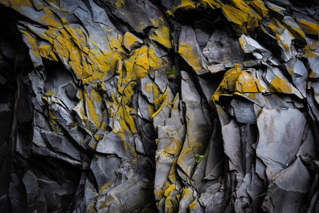
At the heart of GSI’s operations is detailed geological mapping. This involves systematically surveying and documenting the geological features of the land, creating maps that illustrate rock types, structures, and mineral occurrences.
- ✅ Fundamental for Planning: These maps are indispensable for urban planning, infrastructure development, and understanding natural hazards.
- ➡️ From Regional to Detailed: GSI conducts mapping at various scales, from regional reconnaissance surveys to highly detailed large-scale mapping for specific projects.
- 💡 Digital Transformation: The shift towards digital mapping and Geographic Information Systems (GIS) has significantly enhanced the accessibility and utility of GSI’s data. To understand the intricacies involved in such comprehensive data collection, explore Regional Geology: Mapping Earth’s Structures.
Mineral Exploration and Resource Assessment
GSI is the primary agency responsible for the assessment and exploration of mineral resources in India, a critical function for the nation’s economic security.
Geological Survey of India: Pioneering Earth Science – Pros & Cons
Pros
- ✔Vast historical data and extensive foundational geological mapping.
- ✔Crucial role in mineral exploration and national resource assessment.
- ✔Significant contributions to natural hazard mitigation and disaster management.
- ✔Pioneering research in diverse geoscientific fields across India.
Cons
- ✖Challenges with modernizing infrastructure and adopting cutting-edge technology.
- ✖Potential for bureaucratic delays and operational inefficiencies as a large government body.
- ✖Limited public accessibility and dissemination of its extensive data archives.
- ✖Challenges in attracting and retaining top talent amidst competitive global opportunities.
- ⛏️ Identifying New Deposits: Continuous exploration efforts lead to the discovery of new deposits of coal, metallic ores, industrial minerals, and construction materials.
- 📊 Resource Inventory: Maintaining a national inventory of mineral resources, providing crucial data for policy-making and investment.
- ♻️ Sustainable Mining: Advising on environmentally sound mining practices and resource conservation.
Geohazard Assessment and Mitigation
With India’s susceptibility to various natural disasters, GSI plays a vital role in assessing geohazards and contributing to mitigation strategies.
- ⛰️ Landslide Studies: Investigating landslide-prone areas, issuing warnings, and recommending stabilization measures.
- 🌊 Seismic Hazard Mapping: Conducting studies to understand earthquake risk zones and their potential impact. This work complements global efforts, such as those undertaken by USGS: Guardians of Earth’s Dynamics.
- 🔥 Volcanic and Flood Studies: Monitoring active geological phenomena and assessing flood risks in geological contexts.
Contributions to Earth Science Research
Beyond its core functions, GSI is a leading institution for pure and applied earth science research, contributing significantly to global scientific knowledge.
Pioneering Paleontology and Stratigraphy
GSI’s paleontological and stratigraphic work has been instrumental in piecing together India’s ancient geological and biological history.
- Fossil Discoveries: Unearthing significant fossil records that shed light on evolution and past ecosystems.
- Stratigraphic Correlation: Establishing robust stratigraphic frameworks crucial for understanding geological time and resource distribution.
Environmental Geology and Climate Studies
The increasing focus on environmental issues has expanded GSI’s role in studying the interaction between geological processes and the environment.
- Pollution Studies: Investigating geological factors influencing groundwater contamination and soil degradation.
- Climate Change Impact: Assessing the geological impacts of climate change, such as coastal erosion and changes in permafrost.
Hydrogeology and Water Resource Management
GSI contributes critical expertise to the sustainable management of India’s water resources.
- 💧 Groundwater Mapping: Identifying aquifers and assessing groundwater potential across various regions.
- 📈 Water Quality Studies: Analyzing the geological controls on water quality and advocating for responsible water abstraction.
- 💡 Integrated Management: Providing geological inputs for integrated water resource management plans.
GSI’s Role in National Development
The insights and data provided by GSI are integral to India’s developmental initiatives, from infrastructure to resource security.
Supporting Infrastructure Projects
GSI provides essential geological input for major infrastructure projects, ensuring their stability and longevity.

- 🏗️ Dam and Tunnel Construction: Conducting geological investigations for safe and efficient construction of dams, tunnels, and bridges.
- 🛣️ Road and Rail Networks: Providing assessments for stable routes, especially in challenging terrains like the Himalayas.
Resource Security and Sustainable Development
The nation’s reliance on mineral resources makes GSI’s role in resource assessment and management crucial for economic stability and sustainable growth.
- ⭐ Strategic Minerals: Identifying and evaluating deposits of critical and strategic minerals vital for various industries.
- 🌱 Sustainable Practices: Promoting environmentally responsible approaches to resource extraction and land use.
International Collaborations and Expertise Sharing
GSI actively engages with international geological surveys and organizations, fostering knowledge exchange and collaborative research.
- 🤝 Global Partnerships: Collaborating on projects with geological surveys worldwide, sharing best practices and data.
- 🎓 Training and Capacity Building: Offering expertise and training to geoscientists from other developing nations.
Challenges and Future Directions
As GSI looks to the future, it faces new challenges and opportunities, driven by technological advancements and evolving global priorities.
Embracing New Technologies
The integration of cutting-edge technologies is vital for GSI to maintain its leadership in earth science.
- 📡 Advanced Remote Sensing: Utilizing satellite imagery, lidar, and drone technology for more efficient and accurate mapping.
- 🤖 AI and Machine Learning: Applying artificial intelligence for predictive modeling in mineral exploration and hazard assessment.
Addressing Climate Change Impacts
Climate change presents a complex geological challenge, requiring GSI to expand its focus on related studies.
- 🌍 Coastal Vulnerability: Assessing the geological aspects of coastal erosion and sea-level rise.
- 🧊 Glacial Dynamics: Monitoring glacial retreat and its impact on water resources and geohazards in the Himalayas.
Fostering Next-Gen Earth Science Research
Investing in young talent and cutting-edge research is crucial for GSI’s continued relevance and impact.
- 🔬 Interdisciplinary Research: Encouraging collaboration across various scientific disciplines to tackle complex earth system problems.
- 👨🔬 Attracting Talent: Working to inspire and train the next generation of geoscientists to carry forward its legacy. For continued advancements in this field, the Geological Survey of India plays a pivotal role in nurturing future scientific leaders, a commitment acknowledged by prestigious recognitions like the National Geoscience Awards-2023, as detailed in this Press Information Bureau report.
Recommended Video
Conclusion
The Geological Survey of India stands as a testament to the power of sustained scientific inquiry and its direct impact on national prosperity and safety. From its foundational role in geological mapping and mineral resource assessment to its critical contributions in hazard mitigation and cutting-edge earth science research, GSI has consistently proven itself to be an indispensable institution. Its legacy is etched into every major developmental project in India, and its future promises continued leadership in understanding and managing our dynamic planet. As we face global challenges like climate change and resource scarcity, the expertise and data provided by GSI will remain more vital than ever in guiding India towards a sustainable and secure future.
Frequently Asked Questions
When was the Geological Survey of India (GSI) established?
The Geological Survey of India (GSI) was established in 1851 by the British East India Company.
What are the primary functions of the GSI?
GSI’s primary functions include systematic geological mapping, mineral exploration and assessment, engineering geology investigations, marine geological surveys, glaciology, geohazard studies, and fundamental earth science research.
How does GSI contribute to India’s development?
GSI contributes to India’s development by identifying and assessing mineral resources, providing critical data for infrastructure projects, assisting in disaster mitigation, and advancing scientific understanding of the nation’s geological environment.